FEMA's flood maps overlook deadly flash flood risks, leaving homeowners vulnerable
Understanding the Limitations of FEMA Flood Maps
The deadly and destructive flash flooding that occurred in Texas and several other states in July 2025 has sparked a critical conversation about the accuracy and reliability of the U.S. flood maps used to assess flood risks. These maps, developed in the 1970s as part of the National Flood Insurance Program, are essential tools for identifying areas at risk of flooding. However, recent events have exposed significant gaps in their ability to account for changing climate conditions and evolving weather patterns.
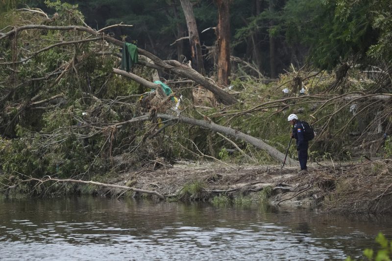
In Texas, the Hill Country region experienced a tragic flash flood on July 4 that claimed more than 130 lives. Just a week later, another round of downpours forced search and rescue teams to pause their efforts to locate missing victims. Similar incidents were reported across the Northeast, Mid-Atlantic, Midwest, and parts of New Mexico, where powerful storms caused widespread damage. In New Mexico, three people were swept away when an RV park flooded, while two others died in New Jersey after their car was pulled into floodwaters. Parts of New York City’s subway system also faced flooding, highlighting the far-reaching impact of these extreme weather events.
FEMA’s Flood Insurance Rate Maps (FIRMs) are designed to guide homeowners, businesses, and local officials in understanding and mitigating flood risks. They are used to determine where flood insurance is required for federally backed mortgages, inform building codes, and support floodplain management strategies. Despite improvements over the years in data accuracy and accessibility, these maps still fail to capture all potential flood risks, particularly those linked to climate change.
The Gaps in Current Flood Mapping
One major limitation of FEMA’s maps is their focus on river channels and coastal flooding, often overlooking the risks associated with intense bursts of rain that lead to flash flooding. This is especially concerning given the increasing frequency of extreme downpours due to rising global temperatures. As a result, many areas that regularly experience flooding are not accurately represented on the maps.
For example, during Hurricane Helene in 2024, flooding hit unmapped areas around Asheville, North Carolina, causing significant uninsured damage. Even in mapped areas, such as the Camp Mystic site in Kerr County, Texas, which was struck by a deadly flash flood in July 2025, the maps may underestimate the actual risk due to reliance on outdated historical data and risk assessments.
Political influence further complicates the mapping process. Local governments and developers sometimes resist high-risk designations to avoid insurance mandates or development restrictions, leading to maps that understate real risks. In New York City, a 2015 FEMA map update was delayed due to legal challenges, resulting in maps that are roughly 20 years old. On average, it takes five to seven years to develop and implement a new FEMA Flood Insurance Rate Map, leaving many communities with outdated information that fails to reflect current land use or evolving flood risks.
Advancements in Technology and Data
New technologies, including satellite imaging, rainfall modeling, and high-resolution lidar, offer the potential to create faster and more accurate flood maps that better account for extreme rainfall and flash flooding. However, integrating these tools requires significant federal investment. Congress controls FEMA’s mapping budget and sets the legal framework for map creation, but updating flood maps has historically been an unpopular topic among elected officials due to concerns about stricter building codes, higher insurance costs, and development restrictions.
In recent years, private flood risk data and climate risk analytics models have provided alternative sources of information. These models incorporate forward-looking climate data, such as projections of extreme rainfall, sea-level rise, and changing storm patterns—factors that FEMA’s maps often overlook. Real estate platforms like Zillow, Redfin, Realtor.com, and Homes.com now offer property-level flood risk scores that consider both historical and future climate data, identifying risks that traditional maps miss.
Research indicates that the availability of this data is influencing property-buying decisions, with more buyers factoring climate change into their choices. While these changes may seem new, the risks have always existed; what is shifting is public awareness.
Preparing for the Future
As homebuyers become more informed about flood risks, the desirability of certain locations may shift, affecting property values, tax revenues, and population trends. The federal government plays a crucial role in ensuring that communities have access to accurate risk assessments. As new tools and models emerge, FEMA must evolve its flood maps to keep pace with the changing climate and emerging threats.
Post a Comment for "FEMA's flood maps overlook deadly flash flood risks, leaving homeowners vulnerable"
Post a Comment