1,800-mile winter storm batters U.S. with snow and travel chaos
A Major Cold Front Sweeps Across the United States
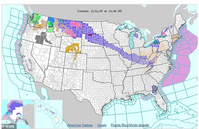
A massive cold front, described as the "mother lode of cold air," is set to impact nearly 2,000 miles of the United States, bringing heavy snow and dangerously low temperatures. The National Weather Service (NWS) has issued winter weather advisories across a vast area that includes parts of Montana, the Dakotas, Minnesota, Iowa, Illinois, Indiana, Kentucky, Ohio, West Virginia, and Pennsylvania. This widespread warning highlights the severity of the upcoming storm.
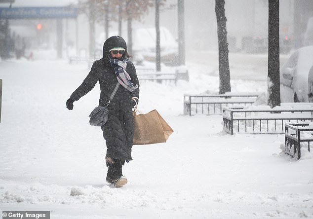
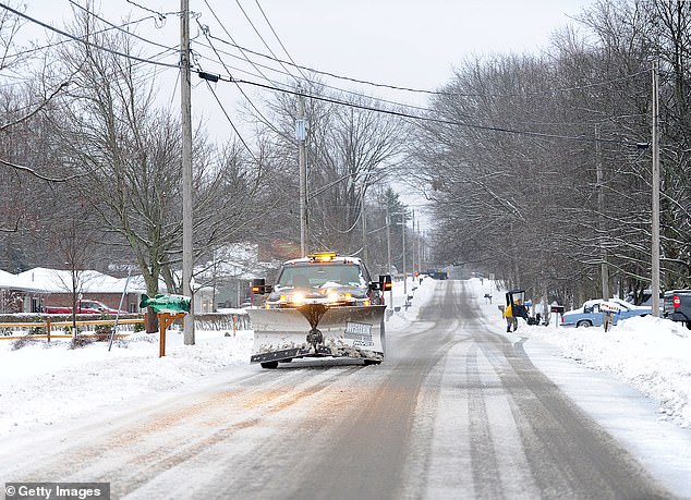
The NWS has forecasted several inches of snowfall between Thursday and Friday, which could lead to reduced visibility for drivers and treacherous road conditions. Cities like Indianapolis and Cincinnati may experience up to six inches of snow, while areas in Montana, Wyoming, and the Dakotas could see between one and two feet of accumulation. The main body of the snowstorm is expected to begin tonight and continue into early Friday across Ohio, Kentucky, Indiana, and southern Illinois, with some regions anticipating up to five inches of snow.
Deteriorating Conditions and Regional Impacts
Conditions are expected to worsen throughout Thursday, affecting morning commutes from Montana to Western Pennsylvania before moving eastward and threatening the East Coast over the weekend. In the Dakotas, ice glaze could form over several inches of snow overnight, while lake-effect snow might push further east, bringing up to six inches of snow into Pennsylvania and New York on Thursday night.
Meteorologists from AccuWeather have noted that this winter blast is being driven by a massive wave of frigid air sweeping down from Canada. This cold air is part of a prolonged polar vortex that has been impacting the US this month. The polar vortex, a large area of cold air that typically remains near the North Pole, can flood into the US when the stable stream of cold air weakens.
Understanding the Polar Vortex
The polar vortex is a giant, spinning whirlpool of cold air high above the North Pole. Normally, strong winds keep this cold air contained in Greenland and Canada, but recent storms and high-pressure systems have disrupted this balance. This disruption has allowed icy air to plunge south into the US, where it collides with warmer air moving north from the Gulf Coast, creating ideal conditions for heavy winter storms in the northern half of the country.
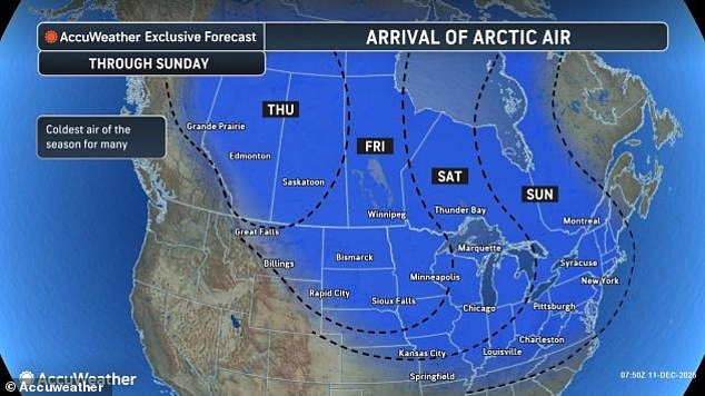
AccuWeather's chief on-air meteorologist, Bernie Rayno, emphasized the intensity of this cold air, calling it the "mother lode of cold air." He explained that the Arctic air currently hitting the US is coming from northwestern Canada, where temperatures have dropped to between -20°F and -30°F. This bone-chilling air is expected to freeze the Plains states on Thursday and Friday before moving into the Great Lakes region on Saturday and the entire Northeast by Sunday.
Health Risks and Long-Term Effects
Forecasters have warned millions of Americans in the path of the polar vortex to avoid prolonged outdoor exposure due to the health risks associated with such extreme cold. AccuWeather's lead long-range meteorologist, Paul Pastelok, highlighted the dangers of hypothermia and frostbite, noting that even brief exposure to these conditions can be life-threatening.
The current polar vortex is not an isolated event. Climatologist Judah Cohen from MIT has stated that computer models predict a third polar vortex episode could hit the US East Coast in the third week of December. These surges of cold air have led to record-low temperatures, and while they often pass quickly, the combination of La Niña and an unstable polar vortex has created a "stuck" pattern, keeping cold air pooled over the eastern US.
Potential for a Break in the Cold
Despite the current harsh conditions, some forecasters believe there may be a break in the frigid weather next week. Current predictions suggest that the jet stream, which flows across the US, may begin to straighten out, pushing the cold Canadian air back north. Pastelok noted that while the cold and snow may feel like Christmas already, the bitterly cold pattern is not expected to last through the holidays.
This ongoing weather phenomenon continues to pose challenges for millions of Americans, with the potential for record-breaking lows and widespread travel disruptions. As the polar vortex continues to shape the weather, the focus remains on preparedness and safety for those in its path.

Post a Comment for "1,800-mile winter storm batters U.S. with snow and travel chaos"
Post a Comment